Overall Topographical Synthesis and Interconnections
From the Environment of Pakistan curriculum
Overall Topographical Synthesis and Interconnections
TL;DR
Pakistan's diverse topography, from high mountains to coastal plains, isn't just random; it's deeply interconnected, shaping the country's climate, rivers, and human activity. Understanding these links helps you see why things are where they are and how they affect each other. This synthesis shows how distinct regions merge into a unified environmental story.
1. The Mental Model
Think of Pakistan's landscape like a giant, interconnected machine. Each part—mountains, plateaus, plains, deserts, coast—has a role, and they all influence each other, especially how water flows and where people live.
2. The Core Material
Pakistan's topography is incredibly varied, ranging from some of the world's highest peaks to flat alluvial plains and arid deserts. It's crucial to understand that these aren't isolated features; they're all linked, forming a complex system that defines the country's environment and human geography.
Let's break down the main topographical regions and their interconnections:
a. Northern Mountains (Himalayas, Karakoram, Hindu Kush)
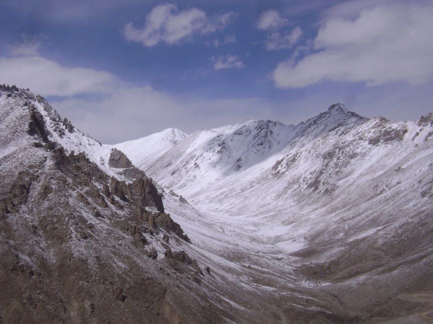
Photo by Nishant Vyas on Pexels
These are Pakistan's "water towers." They're home to glaciers and receive heavy snowfall, feeding all the major rivers. The extreme altitudes create unique microclimates and limit human settlement to valleys.
b. Western Mountains (Sulaiman, Kirthar Ranges)

Photo by Jahanzaib Khan on Pexels
Lower than the northern giants, these ranges are drier and receive monsoon rainfall. They act as barriers, influencing wind patterns and creating rain shadows to their east. They also form a natural boundary with Afghanistan and Iran.
c. Potohar Plateau
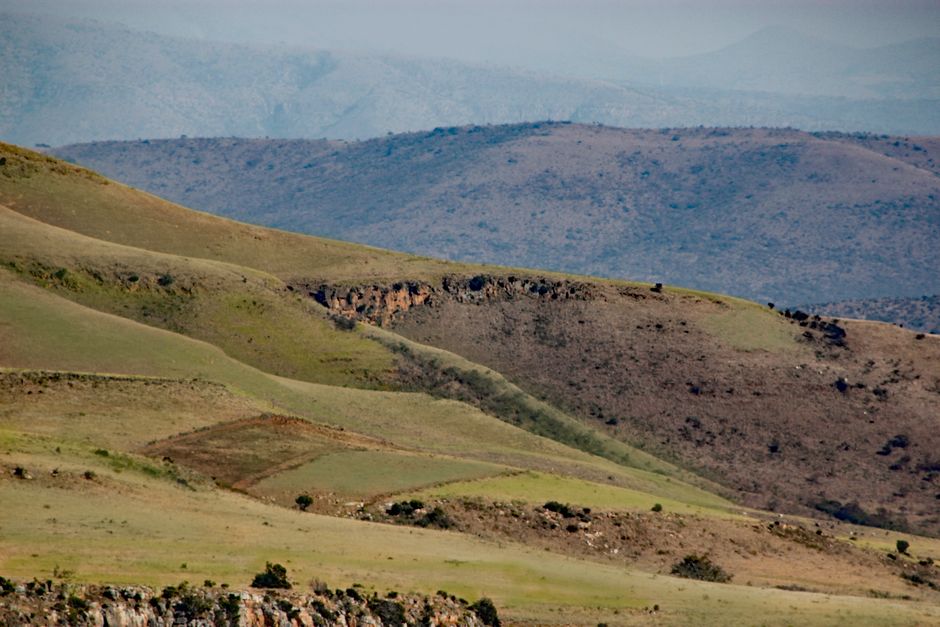
Photo by Kaz Hutton on Pexels
Located between the northern mountains and the Salt Range, this plateau is an eroded landscape. Its elevation makes it slightly cooler than the plains, and it acts as a transition zone, showing effects of both mountain uplift and river erosion.
d. Balochistan Plateau
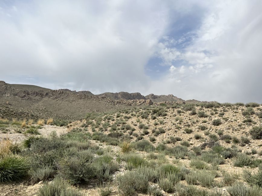
Photo by Jahanzaib Khan on Pexels
This large, arid plateau in the southwest is characterized by barren mountains and vast desert-like plains. It's geographically isolated, leading to sparse population and unique hydrological systems (seasonal rivers, karezes). Its elevation affects local temperatures and rainfall patterns, making it generally hotter and drier than other plateaus.
e. Indus River Plain (Upper and Lower)
This is the heartland of Pakistan, a vast, fertile plain created by the Indus River and its tributaries. It's incredibly flat, allowing for extensive irrigation and agriculture. The plain's existence is entirely dependent on the water flowing from the northern mountains. This is where most of Pakistan's population lives.
f. Deserts (Thar, Cholistan, Thal, Thal, Kharan)
These sandy or stony areas are mainly found on the fringes of the Indus Plain and within Balochistan. They're formed by factors like rain shadow effects from western mountains and their distance from major water sources. They represent areas of extreme aridity, contrasting sharply with the fertile plains.
g. Makran Coast
This narrow strip along the Arabian Sea is characterized by arid coastal mountains and mangrove forests. Its proximity to the sea influences humidity and temperature, though rainfall remains low. It's a critical area for fishing and ports.
Here's how these features are interconnected:
graph TD
    A["Northern Mountains (Himalayas, Karakoram, Hindu Kush)"] --> B["Indus River System (Glaciers, Snowmelt)"];
    B --> C["Indus River Plain (Fertile, Agricultural Heart)"];
    A --> D["Potohar Plateau (Eroded Transition Zone)"];
    D --> C;
    E["Western Mountains (Sulaiman, Kirthar)"] --> F["Rain Shadow Effects"];
    F --> G["Thar, Cholistan, Thal Deserts (Arid Zones)"];
    G --> C;
    E --> H["Balochistan Plateau (Arid, High Elevation)"];
    H --> G;
    C --> I["Makran Coast (River Deltas, Fisheries)"];
    B --> I;
    J["Monsoon Winds"] --> A;
    J --> E;
    J --> C;
    J --> H;
Essentially, the Northern Mountains are the source of most water. This water flows through the Indus River System to create the incredibly fertile Indus River Plain, which supports the bulk of the population and agriculture. The Western Mountains influence rainfall patterns, contributing to the aridity of the Balochistan Plateau and the Deserts. The Potohar Plateau acts as a buffer. Finally, the Makran Coast is where the Indus eventually meets the sea, influenced by both riverine output and oceanic processes. Every part affects the others.
3. Worked Example
Imagine you're trying to understand why a particular region in Pakistan is so dry, like the Thar Desert.
- Identify the region: Thar Desert, eastern Sindh/southern Punjab.
- Look for connections: What's nearby?
- The Indus River Plain is to its west.
- The Sutlej River (a tributary of the Indus) borders it to the north.
- The Aravalli Range in India is to its east (though outside Pakistan, it's relevant).
- The Western Mountains (Sulaiman, Kirthar) are far to the west.
- Analyze interactions:
- The Western Mountains create a rain shadow. While Pakistan's monsoon comes from the southeast, these mountains also block moisture from the west.
- The Indus River brings life to the plain, but the Thar is generally far enough from its main flow and higher up, or on its eastern flank, making irrigation difficult historically.
- The Monsoon winds often have their moisture already depleted by the time they reach the Thar, or they follow different paths. The Aravalli Range in India also influences monsoon wind deflection, contributing to the Thar's aridity.
- The underlying geology and soil type also play a role, as sandy soils hold less water.
Conclusion: The Thar's aridity is a synthesis of its position relative to monsoon wind paths, rain shadow effects from distant mountains, and its distance from the primary Indus irrigation system, all interacting to create a low-rainfall, high-evaporation environment.
4. Key Takeaways
- Pakistan's topography is a mosaic of mountains, plateaus, plains, deserts, and coastlines.
- The northern mountains are crucial as the primary source of water for the entire country.
- The Indus River Plain is the direct result of mountain hydrology and is the agricultural heartland.
- Western mountains often create rain shadow effects, leading to arid regions like Balochistan and parts of the deserts.
- All major topographical features are interconnected, with changes in one region impacting others.
- Understanding these links is vital for grasping Pakistan's climate, resource distribution, and human settlement patterns.
Common mistakes you should avoid:
- Thinking of topographical regions as entirely separate entities without interdependencies.
- Underestimating the role of the northern mountains in feeding the entire river system.
- Forgetting how mountains can create "rain shadows" and influence local aridity.
- Not considering how human activities (like irrigation) are direct responses to natural topography.
5. Now Try It
Choose another specific region in Pakistan, like the Potohar Plateau or the Balochistan Plateau. For your chosen region, describe its main topographical features, and then explain in your own words how it is connected to at least two other major topographical regions of Pakistan. What direct or indirect effects does it have on those regions, or vice versa? What success looks like: You'll clearly link the chosen region to others, explaining specific cause-and-effect relationships (e.g., "Water from X flows to Y," or "Z acts as a barrier affecting W").
Frequently asked about Overall Topographical Synthesis and Interconnections
More from Environment of Pakistan
Get the full Environment of Pakistan curriculum
Clone the complete plan to your dashboard for unlimited AI-generated notes, practice quizzes, and a personalised revision schedule.
Create Free Account