Geographic Foundation of Pakistan
From the Environment of Pakistan curriculum
Geographic Foundation of Pakistan
TL;DR
Pakistan's diverse geography, from towering mountains to fertile plains and arid coasts, profoundly shapes its climate, resources, and human settlements. Its strategic location at the crossroads of South Asia, Central Asia, and the Middle East has historically influenced its culture, trade, and geopolitical significance. Understanding these physical features is crucial to grasping the country's environmental challenges and opportunities.
1. The Mental Model
Imagine Pakistan as a huge, varied canvas painted with extremes: very high mountains in the north, a flat, life-giving river basin in the middle, and dry plateaus and coasts to the west and south. This geography dictates where people live, what they eat, and how they interact with their neighbors.
2. The Core Material
Pakistan's geographic foundation is incredibly diverse, influencing everything from its climate to its economy. You can broadly divide the country into several key physical regions, each with its own characteristics and environmental significance.
2.1 Major Mountain Ranges

Photo by Balazs Simon on Pexels
In the north, Pakistan is home to some of the world's highest mountains. These ranges act as massive barriers, affecting climate patterns, providing crucial water resources, and limiting accessibility.
- Himalayas: The easternmost part of this range extends into Pakistan, including Nanga Parbat, one of the world's highest peaks. These mountains are vital for the Indus River's water supply through snowmelt.
- Karakoram: This range, home to K2 (the world's second-highest peak), lies to the north of the Himalayas. It boasts vast glaciers, which are critical freshwater reserves, but also very harsh conditions.
- Hindu Kush: Extending into Pakistan's northwest, this range is less high than the Karakoram but still formidable. It forms natural boundaries and has historically been a route for invaders and traders through passes like the Khyber Pass.
2.2 Plateaus and Deserts
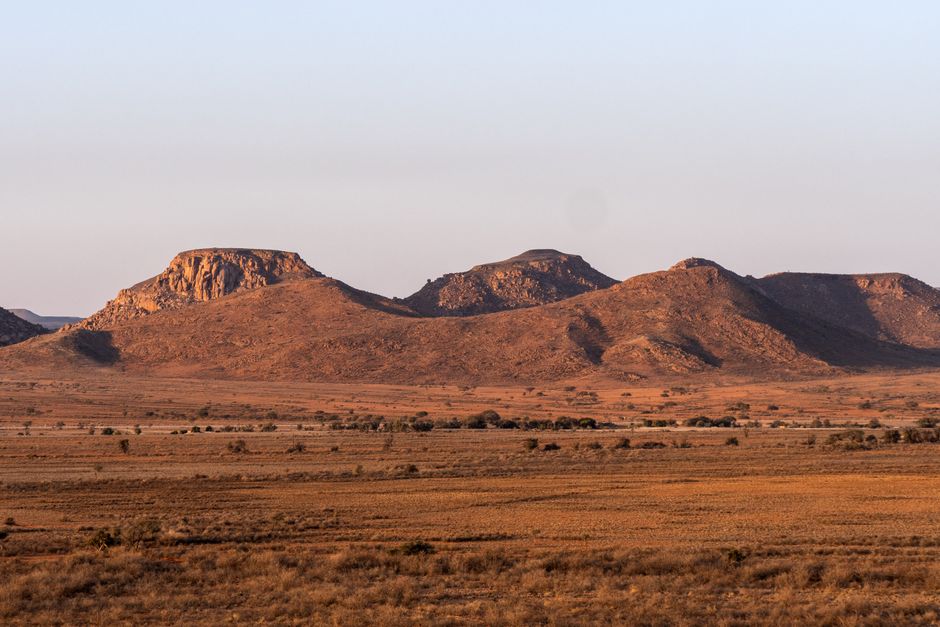
Photo by Rino Adamo on Pexels
Moving south from the mountains, you encounter various plateaus and arid regions.
- Potohar Plateau: Located south of the Himalayas, this plateau is characterized by dissected plains, ravines, and fertile patches, though it's prone to soil erosion. It's an important agricultural and mineral-rich area (salt, oil, gas).
- Balochistan Plateau: This vast, arid plateau covers much of western Pakistan. It's largely barren with sparse rainfall, but rich in mineral resources like copper and natural gas. Its harsh environment supports a pastoral lifestyle.
- Thar Desert: In the southeast, shared with India, the Thar is a large, sandy desert. Life here is challenging due to extreme temperatures and water scarcity, but it has unique biodiversity.
- Thal Desert: Located between the Indus and Jhelum/Chenab rivers, it's a smaller, sandier region.
2.3 The Indus River System and Plains
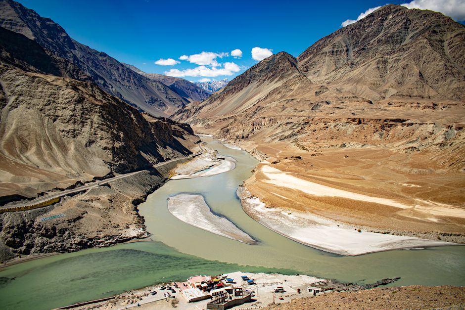
Photo by Bibhukalyan Acharya on Pexels
This is the heartland of Pakistan, where the majority of the population lives and agricultural activity flourishes. The Indus River is the lifeline of the country, fed by the snowmelt and glaciers of the northern mountains.
- Upper Indus Plain: Formed by the Indus and its tributaries (Jhelum, Chenab, Ravi, Sutlej), this is a vast, fertile plain. It's extensively irrigated, making it the agricultural backbone of Pakistan.
- Lower Indus Plain: As the Indus approaches the Arabian Sea, it forms a delta. This region is flatter and hotter, also heavily irrigated, and important for crops like rice.
2.4 Coastal Areas
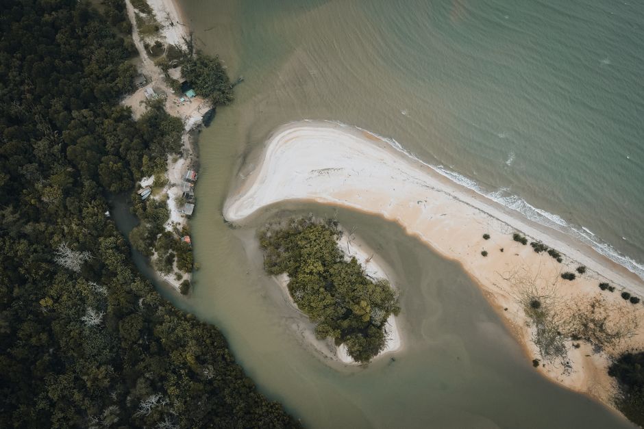
Photo by Pok Rie on Pexels
Pakistan has a coastline along the Arabian Sea, primarily in Sindh and Balochistan.
- Makran Coast: This rugged, arid coast in Balochistan has important fishing communities and ports like Gwadar. It's tectonically active.
- Sindh Coast: Flatter and includes the Indus River Delta, a significant wetland ecosystem important for biodiversity and fisheries.
Here's a simplified view of how these regions are connected:
graph TD
    A["Northern Mountains (Himalayas, Karakoram, Hindu Kush)"] --> B["Indus River System (Glaciers & Snowmelt Source)"];
    B --> C["Upper Indus Plain (Fertile Agricultural Heartland)"];
    C --> D["Lower Indus Plain (Delta & Agriculture)"];
    D --> E["Arabian Sea (Coastal Areas)"];
    A --> F["Potohar Plateau (South of Mountains)"];
    G["Balochistan Plateau (Arid West)"] --> E;
    H["Thar Desert (Southeast)"] --> D;
    B --- F;
    G --- F;
3. Worked Example
Let's consider the impact of the Karakoram Mountain Range on Pakistan's water resources.
You have the Karakoram, with its immense glaciers like Biafo and Baltoro. These glaciers, fed by heavy snowfall, act as natural reservoirs. During the warmer months (spring and summer), these glaciers melt, releasing vast quantities of freshwater. This meltwater flows into rivers, significantly contributing to the Indus River System. For example, the Indus River, originating in Tibet, receives substantial inflows from its tributaries fed by Karakoram glaciers as it flows through Gilgit-Baltistan. This continuous supply of water is then channeled through an extensive network of canals in the Upper and Lower Indus Plains, enabling large-scale irrigation for crops like wheat, rice, and cotton. Without the perennial meltwater from these northern mountains, the agricultural productivity in Pakistan's plains would be drastically reduced, directly impacting food security and the economy.
4. Key Takeaways
- Pakistan's geography is highly diverse, ranging from the world's highest mountains to arid deserts and fertile plains.
- The Indus River is the country's lifeline, with its flow primarily sustained by snowmelt and glaciers from the northern ranges.
- Mountain ranges in the north are crucial water towers, acting as sources for Pakistan's rivers.
- Plateaus like Potohar and Balochistan offer mineral resources but often present challenging living conditions.
- The Thar and Thal deserts highlight regions of extreme aridity, impacting settlement patterns and agricultural potential.
- Pakistan's coastal areas provide access to the Arabian Sea, important for trade, fishing, and port activities.
- The country's strategic location at the confluence of major regions has shaped its historical and geopolitical role.
Common Mistakes to Avoid:
- Don't underestimate the profound link between northern mountains and the fertility of the southern plains.
- Avoid thinking of Pakistan's climate as uniform; it varies wildly from alpine to arid and semi-arid.
- Don't forget the importance of the Indus River beyond just agriculture—it's vital for biodiversity, energy, and human settlement.
- Don't overlook the impact of geography on historical migrations, trade routes, and geopolitical significance.
5. Now Try It
Take a blank map of Pakistan and identify and label the five major physical regions discussed (Northern Mountains, Potohar Plateau, Balochistan Plateau, Indus River Plains, and Coastal Areas). For each region, jot down one key characteristic (e.g., "source of rivers," "arid mineral-rich," "agricultural heartland"). You should be able to clearly delineate these areas and associate them with their primary environmental roles. Success looks like accurately placing and describing the core features of Pakistan's geographic foundation.
Frequently asked about Geographic Foundation of Pakistan
More from Environment of Pakistan
Get the full Environment of Pakistan curriculum
Clone the complete plan to your dashboard for unlimited AI-generated notes, practice quizzes, and a personalised revision schedule.
Create Free Account