The Northern and North-Western Mountain Ranges
From the Environment of Pakistan curriculum
The Northern and North-Western Mountain Ranges
TL;DR
Pakistan's northern and north-western regions are dominated by several major mountain ranges, each with distinct geological features and significant environmental impacts. These ranges, including the Himalayas, Karakoram, and Hindu Kush, shape the climate, river systems, and biodiversity of the country. Understanding their formation and characteristics is key to grasping Pakistan's unique geography.
1. The Mental Model
Imagine Pakistan's northern and western borders as a series of giant, natural walls, built from colliding landmasses. These walls aren't just scenery; they block weather, create rivers, and are home to unique life. Thinking of them as huge, interconnected barriers helps understand their vast influence.
2. The Core Material
Pakistan's northern and north-western regions are home to some of the world's highest and most rugged mountain ranges. These ranges are primarily a result of the ongoing collision between the Indian and Eurasian tectonic plates. This immense geological force has uplifted vast expanses of land, creating towering peaks, deep valleys, and extensive glacier systems.
Major Northern Ranges: Himalayas and Karakoram
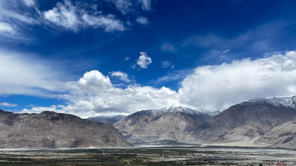
Photo by Saakshi Yadav on Pexels
The Himalayas in Pakistan are the western extension of the grand Himalayan range, featuring several prominent sub-ranges. They are known for their towering peaks, including Nanga Parbat, one of the world's highest mountains. The Lesser Himalayas and the Sub-Himalayas (or Siwaliks) lie to the south, gradually decreasing in altitude and getting more accessible. The Himalayas act as a significant barrier to monsoon winds, influencing rainfall patterns and creating rain shadow areas.
To the north of the Himalayas lies the Karakoram Range, one of the planet's most glaciated regions outside the polar caps. It's home to K2 (Mount Godwin Austen), the second-highest peak in the world. The Karakoram is characterized by its extremely rugged terrain, sharp, jagged peaks, and vast glaciers like Siachen and Baltoro. This range is a crucial water tower, feeding many of Pakistan's major rivers.
Major North-Western Ranges: Hindu Kush and Others
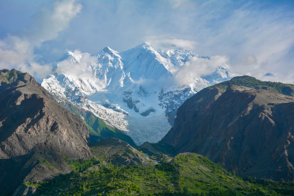
Photo by Younus Sahil Official on Pexels
The Hindu Kush Range primarily extends into Pakistan's north-west, forming a natural boundary with Afghanistan. While generally lower in elevation than the Karakoram or the main Himalayas, it still boasts numerous peaks over 7,000 meters. Tirich Mir is its highest peak. The Hindu Kush is known for its steep, rocky slopes and deep, narrow valleys. It plays a vital role in local climate, often blocking winter depressions and influencing precipitation in the region.
Other significant ranges in the north-west include the Safed Koh and the Sulaiman and Kirthar Ranges. The Safed Koh runs along the Pakistan-Afghanistan border, known for the famous Khyber Pass. The Sulaiman and Kirthar Ranges extend southward from the Hindu Kush, forming the western edge of the Indus River plain. These ranges are generally lower, less glaciated, and have a more arid environment compared to their northern counterparts, though they still influence regional weather and river flow.
graph TD
    A["Tectonic Plate Collision (Indian & Eurasian)"] --> B["Geological Uplift"]
    B --> C["Major Mountain Ranges Formed"]
    C --> D["Northern Ranges"]
    C --> E["North-Western Ranges"]
    D --> D1["Himalayas (e.g., Nanga Parbat)"]
    D --> D2["Karakoram (e.g., K2, Siachen Glacier)"]
    E --> E1["Hindu Kush (e.g., Tirich Mir)"]
    E --> E2["Safed Koh (e.g., Khyber Pass)"]
    E --> E3["Sulaiman & Kirthar Ranges"]
    D1 --> F["Influence Climate & River Sources"]
    D2 --> F
    E1 --> F
    E2 --> F
    E3 --> F
    F --> G["Impact on Biodiversity & Human Settlements"]
Environmental Significance

Photo by Singkham on Pexels
These mountain ranges are the source of most of Pakistan's major rivers, including the Indus and its tributaries. Their glaciers act as natural reservoirs, storing water that's released during warmer months, crucial for agriculture and hydropower. They also create distinct ecological zones, from alpine meadows to coniferous forests, supporting a rich diversity of flora and fauna, many of which are endemic. However, they are also highly vulnerable to climate change, with accelerating glacier melt posing significant long-term threats to water security.
3. Worked Example
Let's consider the impact of the Karakoram Range on Pakistan's water resources. Imagine you're standing in the fertile plains of Punjab in July. The fierce summer heat demands irrigation for crops like wheat and cotton. Where does that water come from? A significant portion originates from the Karakoram. During winter, heavy snowfall accumulates on peaks like K2 and its surrounding glaciers. As temperatures rise in spring and summer, these glaciers melt, feeding rivers such as the Indus and its northern tributaries. Without this meltwater, the agricultural backbone of Pakistan would severely struggle, especially as monsoon rainfall can be unreliable. So, the towering peaks and vast glaciers of the Karakoram are effectively the country's most vital natural water storage system.
4. Key Takeaways
- Pakistan's northern and north-western mountains are primarily formed by the collision of the Indian and Eurasian tectonic plates.
- The Himalayas (with Nanga Parbat) and Karakoram (with K2) are the highest northern ranges, crucial for glacier meltwater.
- The Hindu Kush (with Tirich Mir) forms a significant north-western barrier, influencing regional weather patterns.
- Lower ranges like the Safed Koh, Sulaiman, and Kirthar extend south, impacting local climate and passage.
- These ranges are the primary source of Pakistan's major rivers, essential for agriculture and hydropower.
- They create diverse ecological zones and support unique biodiversity, but are highly vulnerable to climate change.
Common Mistakes:
- Don't confuse the specific ranges; K2 is in Karakoram, not the Himalayas.
- Don't underestimate the role of lower ranges like Sulaiman and Kirthar; they're also significant.
- Avoid thinking these mountains are only about height; their geological formation and climatic influence are equally vital.
- Don't forget that these mountains are dynamic environments, constantly changing due to geological forces and climate.
5. Now Try It
Spend 15 minutes researching one specific pass (e.g., Khyber Pass, Shandur Pass, Babusar Pass) within these mountain ranges. What range is it in? What's its historical significance, and how has it influenced human movement or trade over time? How might its current environmental conditions (e.g., snow, landslides) impact its accessibility today? Success means you can pinpoint its location on a map and explain at least two distinct reasons for its importance.
Frequently asked about The Northern and North-Western Mountain Ranges
More from Environment of Pakistan
Get the full Environment of Pakistan curriculum
Clone the complete plan to your dashboard for unlimited AI-generated notes, practice quizzes, and a personalised revision schedule.
Create Free Account