Tectonic Plate Theory and Processes
From the Geography curriculum
TL;DR
Earth's outer shell is broken into large pieces called tectonic plates, which constantly move and interact. These movements cause major geological events like earthquakes, volcanoes, and the formation of mountains. Understanding plate tectonics helps explain Earth's dynamic surface and natural hazards.
1. The Mental Model
Imagine Earth's surface isn't one solid ball, but a giant, cracked eggshell. These "shell pieces" are always slowly drifting around on the hot, flowing material inside. Where these pieces meet, interesting and often dramatic things happen.
2. The Core Material
Earth's outermost layer, the lithosphere, is made up of the crust and the rigid upper part of the mantle. This lithosphere isn't a single, continuous layer; it's broken into several large and many smaller pieces called tectonic plates. These plates "float" on the semi-fluid asthenosphere, which is part of the upper mantle, and are driven by convection currents within the mantle.
Plate Boundaries
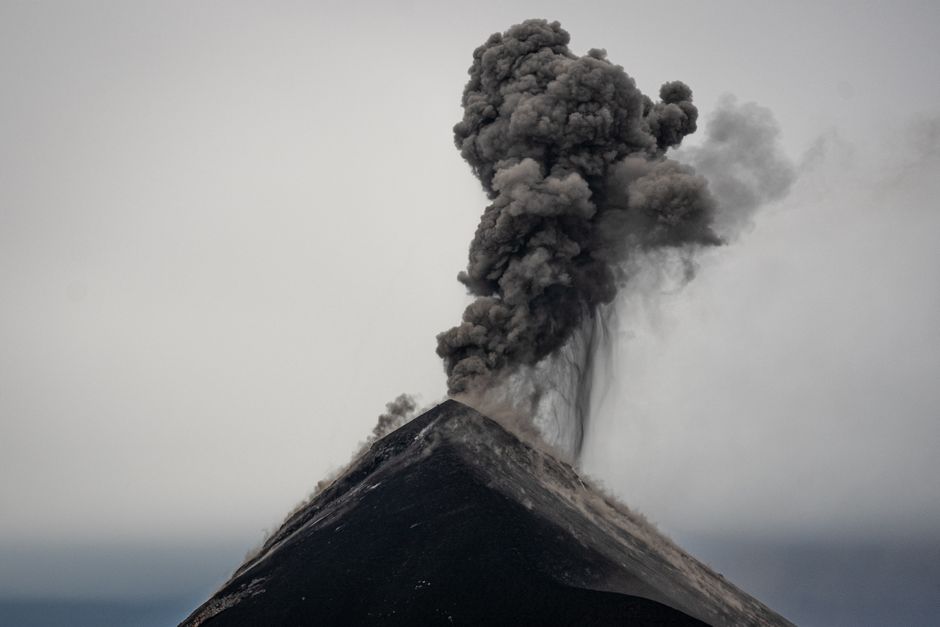
Photo by Diego Girón on Pexels
The interactions between plates at their boundaries are responsible for most of Earth's seismic and volcanic activity. There are three main types of plate boundaries:
- Divergent Boundaries: Plates move away from each other.
- Magma rises from the mantle, creating new crustal material.
- Often found at mid-ocean ridges (like the Mid-Atlantic Ridge) where seafloor spreading occurs.
- Characterized by shallow earthquakes, volcanic activity, and rift valleys.
- Convergent Boundaries: Plates move towards each other.
- Oceanic-Oceanic: One oceanic plate subducts (slides) beneath another. Forms deep ocean trenches and volcanic island arcs (e.g., Mariana Trench, Japanese islands).
- Oceanic-Continental: Oceanic plate subducts beneath a continental plate. Forms ocean trenches and volcanic mountain ranges on the continent (e.g., Andes Mountains).
- Continental-Continental: Neither plate fully subducts due to similar densities, leading to intense compression and uplifting. Forms large mountain ranges (e.g., Himalayas).
- Characterized by earthquakes (shallow to deep), volcanic activity (except for continental-continental), and mountain building.
- Transform Boundaries: Plates slide past each other horizontally.
- No creation or destruction of crust.
- Characterized by frequent, shallow earthquakes, but generally no volcanic activity.
- Often found connecting segments of mid-ocean ridges (e.g., San Andreas Fault).
Driving Forces
Photo by Mihis Alex on Pexels
The primary driving force for plate movement is mantle convection. Hot, less dense material in the mantle rises, spreads laterally, cools, and then sinks as it becomes denser, creating a continuous current. Other forces include:
- Ridge Push: The elevated mid-ocean ridge exerts a force on the oceanic plate, pushing it away from the ridge.
- Slab Pull: The dense, subducting oceanic plate pulls the rest of the plate along behind it. This is considered the strongest driving force.
graph TD
    A["Mantle Convection Currents"] --> B["Movement of Tectonic Plates"]
    B --> C1["Divergent Boundaries"]
    B --> C2["Convergent Boundaries"]
    B --> C3["Transform Boundaries"]

    C1 --> D1a["New crust formed"]
    C1 --> D1b["Volcanoes (mid-ocean ridges, rift valleys)"]
    C1 --> D1c["Shallow earthquakes"]

    C2 --> D2a["Crust destroyed (subduction)"]
    C2 --> D2b["Volcanoes (island arcs, continental arcs)"]
    C2 --> D2c["Mountain ranges formed"]
    C2 --> D2d["Earthquakes (shallow to deep)"]

    C3 --> D3a["Crust neither created nor destroyed"]
    C3 --> D3b["Frequent, shallow earthquakes"]
    C3 --> D3c["No volcanoes"]
3. Worked Example
Let's consider the geological features along the western coast of South America. Here, the Nazca Plate (an oceanic plate) is moving eastward and colliding with the South American Plate (a continental plate).
- Collision Type: This is an oceanic-continental convergent boundary.
- Subduction: The denser Nazca Plate subducts beneath the lighter South American Plate.
- Resulting Features:
- Andes Mountains: As the Nazca Plate subducts, it causes the overriding South American Plate to buckle and uplift, forming the spectacular Andes mountain range.
- Volcanic Arc: As the subducting Nazca Plate descends into the mantle, it melts, and magma rises to the surface, forming a chain of active volcanoes within the Andes.
- Peru-Chile Trench: At the point where the Nazca Plate begins to subduct, a deep ocean trench is formed parallel to the coast.
- Earthquakes: The friction and movement between the two plates cause frequent and powerful earthquakes, some of the strongest in the world.
This example clearly shows how a specific type of plate boundary leads to a predictable suite of geological phenomena.
4. Key Takeaways
- Earth's lithosphere is divided into tectonic plates that are constantly moving.
- Mantle convection, ridge push, and slab pull are the primary forces driving plate movement.
- Divergent boundaries create new crust, often with volcanic activity and shallow earthquakes.
- Convergent boundaries involve plates colliding, leading to subduction, mountain building, volcanoes, and a wide range of earthquake depths.
- Transform boundaries involve plates sliding past each other, causing frequent shallow earthquakes but no volcanoes.
- The type of plate boundary dictates the specific geological features and hazards found in an area.
-
Plate tectonics helps explain the distribution of earthquakes, volcanoes, and mountain ranges globally.
-
Common Mistakes to Avoid:
- Confusing plate boundaries with entire plates themselves.
- Forgetting that continental-continental convergence doesn't typically produce volcanoes.
- Assuming all plate movements are fast; they're usually only a few centimeters per year.
- Thinking that the entire mantle is liquid; it's mostly solid but behaves plastically (flows) over geological timescales.
5. Now Try It
Imagine you're examining a map showing a long, linear chain of active volcanoes in the ocean, far from any continents, along with a very deep ocean trench next to them. Based on what you've learned, what type of plate boundary would you infer is present here? What kind of geological events (earthquakes, mountain building) would you expect to occur in this region, and why? Spend 15 minutes sketching out your answer and justifying your reasoning using the concepts of plate tectonics.
Frequently asked about Tectonic Plate Theory and Processes
Study this next
Get the full Geography curriculum
Clone the complete plan to your dashboard for unlimited AI-generated notes, practice quizzes, and a personalised revision schedule.
Save this course free