Applications and Problem Solving in Distance Measurement
From the Fundamentals of Surveying 1 curriculum
TL;DR
Distance measurement is fundamental to all surveying tasks, providing the basis for location, area, and volume calculations. You'll often combine direct and indirect methods, choosing the best approach based on required accuracy and site conditions. Problem-solving involves understanding the limitations of each technique and applying appropriate corrections.
1. The Mental Model
Think of distance measurement as the "ruler" of surveying. Just like a carpenter needs to measure wood precisely, a surveyor needs to measure distances on the Earth's surface accurately to build a reliable spatial picture. Your goal is to select the right "ruler" (method) for the job and use it correctly.
2. The Core Material
Measuring distances is at the heart of surveying. Whether you're laying out a building, mapping a property, or tracking ground movement, an accurate distance is essential.
Direct Distance Measurement

Photo by Nathan J Hilton on Pexels
This is what it sounds like: directly applying a measuring device along the line you want to measure.
- Taping/Chaining: Involves using a steel tape or chain. It's precise for shorter distances but becomes laborious and prone to error over long stretches or uneven terrain.
- Common Applications: Property boundary re-establishment, layout of small structures, checking other measurements.
- Pacing: Your own two feet! Useful for quick estimates or reconnaissance. It's not accurate enough for most serious surveying.
- Common Applications: Rough estimates, checking for gross errors in other measurements.
- Odometer: Measuring distance based on wheel rotations. Good for preliminary work or road surveys where high precision isn't needed.
- Common Applications: Route surveys, quick linear measurements along roads.
Electronic Distance Measurement (EDM)

Photo by Castorly Stock on Pexels
EDM instruments use electromagnetic waves to determine distances. They're much faster and more accurate than taping for most applications.
- Total Stations: Combine an EDM with an electronic theodolite (for angles). They are the workhorse of modern surveying.
- How it works: The instrument sends an electromagnetic wave to a prism (reflector) and measures the time it takes for the wave to return. Knowing the speed of the wave, it calculates the distance.
- Common Applications: Topographic surveys, construction layout, control surveys, property surveys.
- GPS/GNSS: Global Positioning System (and other Global Navigation Satellite Systems) use satellite signals to determine positions, from which distances can be derived. Offers high accuracy over long distances without line-of-sight issues (in clear areas).
- Common Applications: Large-scale control networks, mapping, navigation, precise positioning.
- Laser Scanners/Lidar: Use laser pulses to capture millions of 3D points quickly. Excellent for complex shapes and large areas.
- Common Applications: Building information modeling (BIM), terrain modeling, forensics, historical preservation.
Indirect Distance Measurement
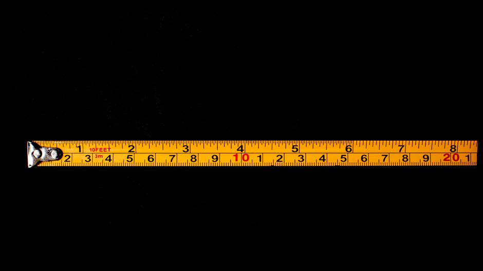
Photo by Nothing Ahead on Pexels
Sometimes you can't measure directly, or it's impractical. You'll use geometry and trigonometry to calculate distances.
- Stadia: An older method using a telescopic instrument with stadia hairs to estimate distance based on the interval intercepted on a graduated rod. Less common now but good for understanding principles.
- Trigonometric Levelling: Uses measured vertical angles and a known horizontal distance to calculate elevation differences, or vice-versa.
- Triangulation/Trilateration: Building a network of triangles. In triangulation, you measure angles and at least one baseline distance to calculate other distances. In trilateration, you measure all sides (distances) to determine positions.
Here's how you'd typically select a distance measurement method:
graph TD
    A["Start: Need to Measure Distance"] --> B{Required Accuracy?};
    B -- "High (mm to cm)" --> C{Line of Sight Available?};
    B -- "Medium (cm to dm)" --> D{Long Distance?};
    B -- "Low (m)" --> E{Quick Estimate Needed?};

    C -- "Yes" --> F["Total Station / EDM"];
    C -- "No / Obstructed" --> G["GPS/GNSS"];
    F --> H["Final Check / Corrections"];
    G --> H;

    D -- "Yes" --> I["GPS/GNSS"];
    D -- "No / Shorter" --> J["Taping / Total Station"];
    I --> H;
    J --> H;

    E -- "Yes" --> K["Pacing / Odometer"];
    K --> H;

    H --> L["Result: Measured Distance"];
Problem Solving: Common Issues and Corrections

Photo by Ann H on Pexels
No measurement is perfect. You'll always need to consider potential errors and apply corrections.
- Systematic Errors (Correctable):
- Tape Corrections:
- Standardization: If your tape isn't exactly its stated length, you'll need to correct for that.
- Temperature: Steel tapes expand and contract with temperature.
- Sag: If the tape isn't fully supported, it sags, making the measured distance appear longer than the true horizontal.
- Tension: Applying too much or too little tension affects the tape's length.
- Slope: Most distances are required horizontally. If measured on a slope, you must reduce it to the horizontal.
- EDM/Total Station Corrections:
- Atmospheric Conditions: The speed of the electromagnetic wave changes with temperature, pressure, and humidity. EDM instruments have built-in corrections or you input these values.
- Instrument/Reflector Constant: A small offset inherent in the instrument and prism design.
- Tape Corrections:
- Random Errors (Unpredictable, reduced by averaging): Errors due to human limitations (e.g., misreading a scale slightly, slight wobbling of a plumb bob).
- Gross Errors (Blunders): Major mistakes like miscounting tape lengths, transposing numbers, or reading the wrong point. Always check your work!
Formulas for Common Corrections:
-
Slope Correction (to Horizontal Distance):
$HD = \sqrt{SD^2 - VD^2}$ or $HD = SD \times \cos(\alpha)$
Where:- $HD$ = Horizontal Distance
- $SD$ = Slope Distance (measured)
- $VD$ = Vertical Difference (difference in elevation)
- $\alpha$ = Vertical angle (slope angle)
-
Temperature Correction for Steel Tape:
$C_t = L \times \alpha \times (T_m - T_s)$
Where:- $C_t$ = Temperature correction
- $L$ = Measured length
- $\alpha$ = Coefficient of thermal expansion for steel (approx. $0.0000115 /^\circ C$)
- $T_m$ = Measured temperature
- $T_s$ = Standard temperature of the tape (usually $20^\circ C$)
3. Worked Example
Let's say you've measured a slope distance (SD) of 125.450 m between two points with a Total Station. You also measured the vertical angle ($\alpha$) as +5°30'15" (meaning point B is uphill from A). You need the horizontal distance (HD).
Given:
* Slope Distance (SD) = 125.450 m
* Vertical Angle ($\alpha$) = 5°30'15"
Formula: $HD = SD \times \cos(\alpha)$
Step 1: Convert the vertical angle to decimal degrees (or use your calculator's DMS function).
$5^\circ30'15" = 5 + (30/60) + (15/3600) = 5 + 0.5 + 0.004166... = 5.504166...^\circ$
Step 2: Calculate the cosine of the angle.
$\cos(5.504166...^\circ) \approx 0.99539$
Step 3: Multiply the slope distance by the cosine of the angle.
$HD = 125.450 \times 0.99539$
$HD \approx 124.877 \text{ m}$
So, the true horizontal distance between the two points is approximately 124.877 meters.
4. Key Takeaways
- Always choose the distance measurement method that balances required accuracy, site conditions, and budget.
- Understand the principles behind both direct and indirect measurement techniques.
- EDM/Total Stations are essential for modern surveying due to their speed and precision.
- GPS/GNSS offers excellent accuracy over long distances, especially where line-of-sight is an issue.
- All measurements contain errors; recognizing and applying corrections (like for slope or temperature) is crucial for accurate results.
- Systematic errors can be mathematically corrected, while random errors are minimized by good field practices and averaging.
- Always double-check your readings and calculations to catch gross errors.
5. Now Try It
You're surveying a property boundary. You've taped a section on a slight slope. The measured tape distance (SD) is 60.250 m. Using a level, you find the difference in elevation (VD) between the start and end points is 1.850 m. Calculate the horizontal distance (HD) for this segment. What success looks like: a calculated HD to three decimal places, using the appropriate formula.
Frequently asked about Applications and Problem Solving in Distance Measurement
More from Fundamentals of Surveying 1
Get the full Fundamentals of Surveying 1 curriculum
Clone the complete plan to your dashboard for unlimited AI-generated notes, practice quizzes, and a personalised revision schedule.
Save this course free