Introduction to Surveying and Geomatics
From the Fundamentals of Surveying 1 curriculum
TL;DR
Surveying is the art and science of determining the relative positions of points on or near the Earth's surface. Geomatics is a broader field that integrates surveying with other spatial data technologies like GIS and remote sensing. Together, they provide essential data for mapping, engineering, and environmental management.
1. The Mental Model
Imagine you're trying to build something – a road, a house, even just a detailed map. You need to know exactly where everything is relative to everything else. Surveying is how you get those precise measurements, and Geomatics is the toolbox that helps you collect, manage, and understand all that spatial information.
2. The Core Material
Surveying is fundamentally about measurement and mapping. You're measuring distances, angles, and elevations to create a spatial representation of a specific area. This data is critical for virtually all construction, infrastructure development, and land management projects.
What is Surveying?

Photo by Khoiru Ummah Kendari 24 on Pexels
At its core, surveying involves:
1. Measurement: Using specialized instruments (like total stations, GPS receivers) to capture real-world data points.
2. Calculation: Applying mathematics to process these raw measurements and determine precise coordinates, areas, and volumes.
3. Mapping/Representation: Presenting the calculated data in a usable format, such as maps, plans, or 3D models.
The primary goal is to determine the three-dimensional coordinates (Latitude, Longitude, and Elevation) of points on the Earth's surface relative to a reference system.
Branches of Surveying
Photo by Khoiru Ummah Kendari 24 on Pexels
- Geodetic Surveying: Accounts for the Earth's curvature. Used for large areas, national boundaries, and high-precision scientific work.
- Plane Surveying: Assumes the Earth is a flat plane. Suitable for smaller areas (typically less than 250 km²) where the curvature effect is negligible. Most civil engineering and construction surveys fall into this category.
Introduction to Geomatics
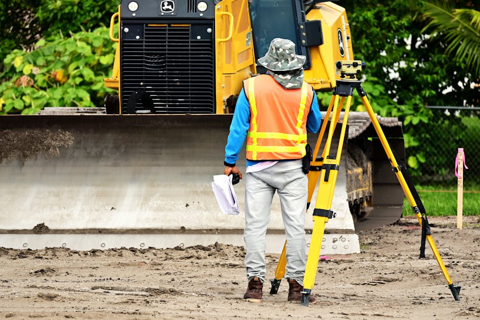
Photo by Nelson Axigoth on Pexels
Geomatics is a modern, broader term that encompasses surveying but also integrates many other technologies for collecting, storing, processing, and delivering geographic information. Think of it as the umbrella discipline for all things spatial data.
Key components of Geomatics include:
* Surveying: As discussed, the foundation for precise spatial data acquisition.
* Global Navigation Satellite Systems (GNSS): Like GPS, GLONASS, Galileo, Beidou, used for positioning and navigation.
* Geographic Information Systems (GIS): Software systems for storing, analyzing, and visualizing spatial data (maps).
* Remote Sensing: Acquiring information about an object or phenomenon without making physical contact, often from satellites or aircraft (e.g., aerial photography, satellite imagery).
* Cartography: The art and science of making maps.
* Photogrammetry: Deriving accurate measurements from photographs, often used to create 3D models.
Geomatics professionals use these tools to solve complex spatial problems, from urban planning to disaster management.
The Surveying and Geomatics Workflow
Photo by Khoiru Ummah Kendari 24 on Pexels
Here's a simplified look at how surveying and geomatics often work together:
graph TD
    A["Need for Spatial Data (e.g., New Road Project)"] --> B["Planning & Design (What data do we need?)"]
    B --> C["Data Acquisition (Surveying, GPS, Remote Sensing)"]
    C --> D["Data Processing & Analysis (Calculations, GIS Analysis)"]
    D --> E["Data Presentation (Maps, Plans, 3D Models)"]
    E --> F["Decision Making & Implementation (Construction, Environmental Management)"]
    F --> G["Monitoring & Updates (New Surveys, Remote Sensing)"]
3. Worked Example
Imagine a developer wants to build a new housing complex on a 50-acre plot of land.
- Initial Request: The developer needs a topographic map of the entire site, showing elevation changes, existing features (trees, fences, utilities), and boundary lines.
- Surveying Team Mobilizes: A surveying team arrives on site with GNSS receivers and a total station.
- They use GNSS to establish control points with high accuracy, tying the local survey into a national coordinate system.
- They then use the total station to meticulously measure thousands of points across the site: ground elevations, tree locations, existing structures, and property corners.
- Data Processing: Back in the office, the raw field measurements (angles, distances, GNSS observations) are downloaded into specialized software.
- The software calculates the precise X, Y, Z coordinates for all measured points.
- Boundary lines are computed based on legal descriptions and measured corners.
- Geomatics Integration (GIS): The processed survey data (points, lines, elevations) is imported into a GIS platform.
- This data is then layered with other relevant information:
- Existing utility maps (from the local municipality).
- Zoning regulations (from planning departments).
- Environmental sensitivity layers (from state agencies).
- Aerial imagery of the site (from remote sensing).
- The GIS analyst can then generate contour maps, analyze slopes for drainage, identify buildable areas, and create a comprehensive site plan.
- This data is then layered with other relevant information:
- Final Deliverables: The output includes a detailed topographic map, a boundary survey, and a digital GIS database, which the developer uses for design, permitting, and construction.
4. Key Takeaways
- Surveying is about precise measurement of points on or near Earth's surface to determine their relative positions.
- Geodetic surveying accounts for Earth's curvature, while plane surveying assumes a flat surface for smaller areas.
- Geomatics is a broader field integrating surveying with technologies like GNSS, GIS, remote sensing, and photogrammetry.
- Both disciplines are crucial for accurate mapping, infrastructure development, and land management.
- The fundamental output is accurate spatial data, often represented as maps or 3D models.
- Common Mistakes to Avoid:
- Assuming plane surveying is always sufficient; always check the project scale.
- Not understanding the difference between absolute and relative positioning.
- Neglecting to establish proper control points, which can lead to errors accumulating.
- Overlooking the importance of proper data documentation and metadata.
5. Now Try It
Think about a recent construction project or infrastructure development you've seen (e.g., a new building, a road expansion, a park). Spend 15 minutes considering:
1. What specific surveying measurements do you think were necessary for that project?
2. How might Geomatics technologies (like GIS or satellite imagery) have been used to plan or execute it?
Success looks like you can clearly articulate at least three distinct surveying tasks and two Geomatics applications related to your chosen project.
Frequently asked about Introduction to Surveying and Geomatics
More from Fundamentals of Surveying 1
Get the full Fundamentals of Surveying 1 curriculum
Clone the complete plan to your dashboard for unlimited AI-generated notes, practice quizzes, and a personalised revision schedule.
Save this course free