The Earth's Internal Processes and Landforms
From the Geography p1 curriculum
TL;DR
The Earth's interior is a dynamic system powered by heat, driving plate tectonics. These movements create powerful forces that shape the planet's surface, forming various distinctive landforms. Understanding these processes helps us explain phenomena like earthquakes, volcanoes, and mountain ranges.
1. The Mental Model
Imagine the Earth like a giant, hot stew: heat from the bottom creates currents, moving ingredients around. On Earth, these currents are in the mantle, slowly shifting huge pieces of the crust (plates), which then collide, pull apart, or slide past each other, creating all the dramatic landscapes we see.
2. The Core Material
The Earth's internal processes are primarily driven by geothermal heat originating from radioactive decay in the core and mantle. This heat creates convection currents in the semi-molten mantle, which in turn drive the movement of the rigid tectonic plates that make up the Earth's lithosphere (crust and uppermost mantle).
There are three main types of plate boundaries, each associated with specific landforms and geological events:
2.1 Divergent Plate Boundaries
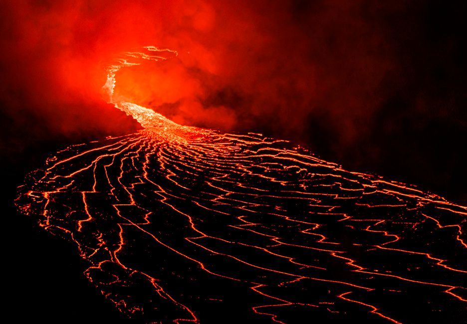
Photo by Daniel Torobekov on Pexels
Here, plates move apart from each other. Magma rises from the mantle to fill the gap, creating new oceanic crust.
* Features: Mid-ocean ridges (e.g., Mid-Atlantic Ridge), rift valleys (e.g., East African Rift Valley), volcanoes, shallow earthquakes.
2.2 Convergent Plate Boundaries
Photo by Daniel Torobekov on Pexels
Here, plates move towards each other, leading to collision or subduction (one plate sliding beneath another).
* Oceanic-Continental Convergence: Denser oceanic plate subducts under the lighter continental plate.
* Features: Ocean trenches (e.g., Peru-Chile Trench), volcanic mountain ranges (e.g., Andes Mountains), strong earthquakes.
* Oceanic-Oceanic Convergence: One oceanic plate subducts under another.
* Features: Ocean trenches, volcanic island arcs (e.g., Mariana Islands, Japan), strong earthquakes.
* Continental-Continental Convergence: Neither plate is dense enough to subduct significantly, leading to intense folding and faulting.
* Features: Large fold mountain ranges (e.g., Himalayas), wide earthquake zones.
2.3 Transform Plate Boundaries

Photo by HONG SON on Pexels
Here, plates slide horizontally past each other.
* Features: Fault lines (e.g., San Andreas Fault), frequent shallow earthquakes, no significant volcanic activity or mountain building directly at the boundary.
These interactions are responsible for various endogenic landforms (those created by forces from within the Earth).
graph TD
    A["Geothermal Heat (Core/Mantle)"] --> B["Mantle Convection Currents"]
    B --> C["Plate Movement"]

    C --> D1["Divergent Boundary"]
    D1 --> E1["Mid-Ocean Ridges"]
    D1 --> E2["Rift Valleys"]
    D1 --> E3["Volcanoes"]

    C --> D2["Convergent Boundary"]
    D2 --> F1["Oceanic-Continental"]
    F1 --> G1["Oceanic Trenches"]
    F1 --> G2["Volcanic Mountain Ranges"]
    D2 --> F2["Oceanic-Oceanic"]
    F2 --> H1["Oceanic Trenches"]
    F2 --> H2["Volcanic Island Arcs"]
    D2 --> F3["Continental-Continental"]
    F3 --> I1["Fold Mountain Ranges"]

    C --> D3["Transform Boundary"]
    D3 --> J1["Fault Lines"]
    D3 --> J2["Earthquakes"]

    E1 & E2 & E3 & G1 & G2 & H1 & H2 & I1 & J1 & J2 --> K["Endogenic Landforms & Phenomena"]
3. Worked Example
Let's consider the formation of the Andes Mountains along the western coast of South America.
1. Process: The Nazca Plate (oceanic) is moving eastward and subducting beneath the South American Plate (continental). This is an oceanic-continental convergent boundary.
2. Mechanism: As the Nazca Plate descends into the mantle, it melts, generating magma. This magma rises to the surface, forming a chain of volcanoes along the edge of the South American Plate.
3. Landform: The immense pressure and friction from the subducting plate also cause the overlying continental crust to buckle, fold, and uplift, creating the towering Andes Mountain range.
4. Associated Phenomena: The subduction zone also generates frequent and powerful earthquakes as stresses build up and are released along the fault lines. An example is the 1960 Valdivia earthquake in Chile, one of the strongest ever recorded.
4. Key Takeaways
- Plate tectonics is the overarching theory explaining how the Earth's lithosphere moves.
- Heat from the Earth's core drives convection currents in the mantle, causing plates to move.
- Divergent boundaries create new crust and features like mid-ocean ridges and rift valleys.
- Convergent boundaries lead to subduction or collision, forming trenches, volcanic arcs, and fold mountains.
- Transform boundaries involve plates sliding past each other, causing frequent earthquakes.
- Understanding plate boundaries helps predict locations of volcanoes and earthquakes.
- All major endogenic landforms are direct results of these plate interactions.
Common Mistakes to Avoid

Photo by KATRIN BOLOVTSOVA on Pexels
- Confusing mantle convection (driving force) with plate movement (the result).
- Attributing all mountain ranges to a single type of boundary; fold mountains are distinct from volcanic mountain ranges.
- Thinking that volcanoes occur at transform boundaries; they are primarily associated with divergent and convergent boundaries.
- Forgetting that earthquakes can occur at all three major boundary types, though their characteristics (depth, intensity) vary.
5. Now Try It
Spend 15 minutes researching the East African Rift Valley. Identify which type of plate boundary it represents, what landforms are currently being created there, and what geological future is predicted for that region. Success looks like being able to clearly explain why it's a rift valley and what specific evidence supports its formation type.
Frequently asked about The Earth's Internal Processes and Landforms
Study this next
Get the full Geography p1 curriculum
Clone the complete plan to your dashboard for unlimited AI-generated notes, practice quizzes, and a personalised revision schedule.
Save this course free