Weather and Climate Systems
From the geography for y9 students at chms exam curriculum
TL;DR
Weather describes the short-term atmospheric conditions we experience daily, while climate is the average weather pattern over many years in a specific area. These systems are driven by the sun's energy, which heats the Earth unevenly, causing air and ocean currents that redistribute heat and moisture globally. Understanding these differences helps us predict short-term changes and analyze long-term trends affecting our planet.
1. The Mental Model
Imagine weather as what you wear today – it changes quickly. Climate is like your entire wardrobe, reflecting what you typically wear throughout the year based on where you live. Both are about the atmosphere, but one is about the immediate moment and the other is about long-term patterns.
2. The Core Material
Weather and climate might sound similar, but they're fundamentally different concepts. Let's break down what each means and how they work.
What is Weather?

Photo by Khoa Võ on Pexels
Weather is the day-to-day state of the atmosphere. It's what you experience when you step outside: is it sunny, cloudy, raining, windy? It can change hour-to-hour, day-to-day, or even week-to-week. Key elements of weather include:
* Temperature: How hot or cold it is.
* Precipitation: Any form of water falling from the atmosphere (rain, snow, hail).
* Humidity: The amount of water vapour in the air.
* Wind: The movement of air.
* Atmospheric Pressure: The weight of the air above a surface.
* Cloud Cover: How much of the sky is covered by clouds.
Weather is driven by the transfer of energy (mostly from the sun) and moisture within the atmosphere.
What is Climate?
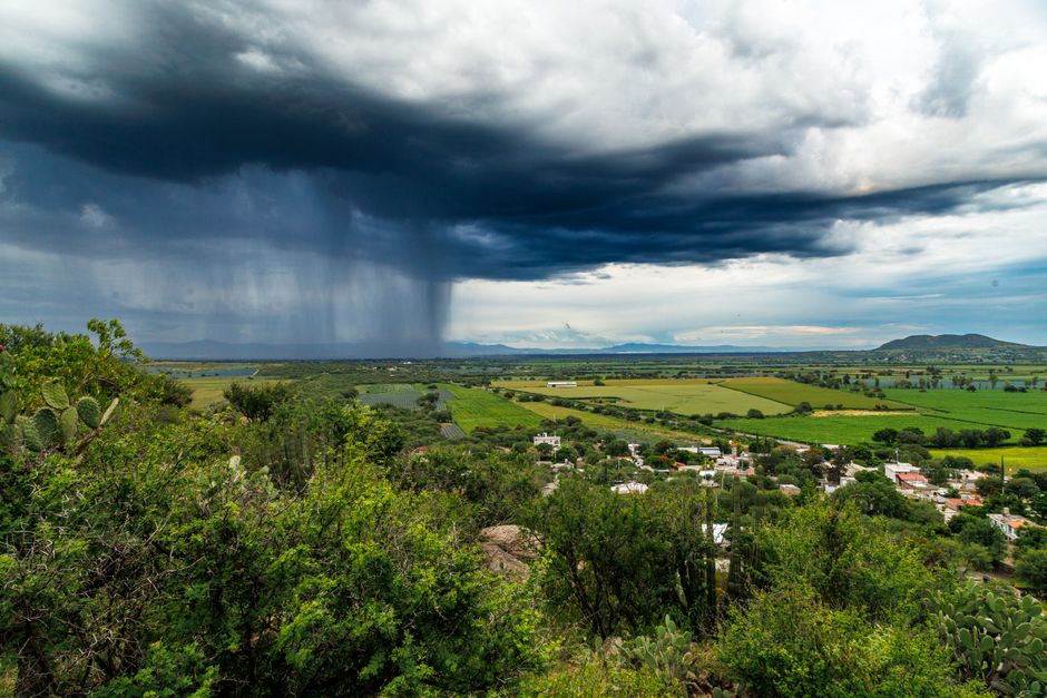
Photo by Josias Salinas on Pexels
Climate is the average weather pattern for a particular region over a long period, typically 30 years or more. It's about trends and typical conditions, not individual days. For example, London has a temperate climate (mild summers, cool winters, frequent rain), even though it might have a very hot or cold day occasionally. Factors influencing climate include:
* Latitude: How far north or south of the Equator you are.
* Altitude: How high above sea level you are.
* Distance from the sea: Coastal areas often have milder climates than inland areas.
* Ocean currents: Warm or cold currents can significantly impact coastal temperatures.
* Prevailing winds: Constant wind directions can bring specific weather types.
* Relief (topography): Mountains can block moisture, creating rain shadows.
How Weather and Climate Systems Work
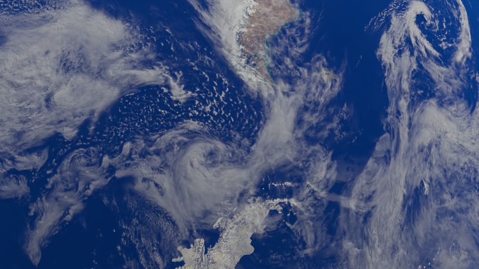
Photo by Zelch Csaba on Pexels
The sun is the primary driver of both weather and climate. Its energy heats the Earth unevenly. The Equator gets more direct sunlight, making it hotter, while the poles receive less direct sunlight and are colder. This uneven heating creates temperature differences, which lead to differences in air pressure.
1. Atmospheric Circulation:
* Hot air at the Equator rises, creating low pressure.
* This rising air cools and moves towards the poles.
* At around 30 degrees latitude (north and south), the cool, dense air sinks, creating high pressure.
* This sinking air then flows back towards the Equator or towards the poles as surface winds.
* This continuous movement forms global atmospheric circulation cells (like the Hadley, Ferrel, and Polar cells), which redistribute heat and moisture.
2. Ocean Currents:
* Ocean currents are also driven by differences in water temperature and salinity, as well as by prevailing winds.
* They act like giant conveyor belts, moving warm water from the Equator towards the poles and cold water from the poles towards the Equator.
* This significantly influences the climate of coastal regions. For instance, the North Atlantic Drift brings warm water to Western Europe, giving it a milder climate than other places at the same latitude.
3. The Water Cycle:
* Evaporation, condensation, precipitation, and collection are all key parts of the water cycle.
* The sun's energy drives evaporation, putting moisture into the atmosphere.
* This moisture then moves with air currents, condenses to form clouds, and eventually falls as precipitation, distributing water globally.
Here's a simplified view of how these systems interact:
graph TD
    A["Sun's Energy (Uneven Heating)"] --> B["Temperature Differences (Equator Hotter, Poles Colder)"]
    B --> C["Air Pressure Differences (Low Pressure at Equator, High Pressure at Poles)"]
    C --> D["Global Atmospheric Circulation (Hadley, Ferrel, Polar Cells)"]
    D --> E["Prevailing Winds & Jet Streams"]
    E --> F["Ocean Currents (Driven by Wind/Temperature/Salinity)"]
    F --> G["Heat & Moisture Redistribution"]
    G --> H["Local Weather Patterns"]
    G --> I["Regional Climate Zones (Long-Term Averages)"]
    H --> J["Short-term Atmospheric Conditions (e.g., Today's Rain)"]
    I --> K["Average Weather over 30+ Years (e.g., Temperate Climate)"]
    J -- "Observed" --> H
    K -- "Defined by" --> I
Climate Change

Photo by Bren Pintelos on Pexels
It's important to briefly touch on climate change. This refers to a significant and lasting change in the statistical distribution of weather patterns over periods ranging from decades to millions of years. It's a change in the average weather conditions (the climate) of a region or the planet. While weather is natural variability, climate change is a long-term shift, often attributed to human activities impacting the Earth's energy balance.
3. Worked Example
Let's look at two hypothetical places: City A and City B, both at roughly the same latitude, say 45 degrees North, similar to parts of Southern France or Northern Italy.
City A is located deep inland, surrounded by large landmasses.
City B is located on the coast, next to a major warm ocean current.
Over a 30-year period:
-
City A's Climate:
- Summer: Average temperature of 28°C, often reaching 35°C, with low humidity. Rainfall is infrequent, typically in thunderstorms.
- Winter: Average temperature of -5°C, often dropping to -15°C, with frequent snow.
- Overall: Experiences a continental climate with large temperature differences between summer and winter. This is due to land heating up and cooling down quickly compared to water.
-
City B's Climate:
- Summer: Average temperature of 22°C, rarely exceeding 28°C, with higher humidity. Rainfall is moderate and fairly consistent throughout the year.
- Winter: Average temperature of 5°C, rarely dropping below 0°C, with rain more common than snow.
- Overall: Experiences a maritime climate (or oceanic climate) with mild summers and mild winters, and less extreme temperature ranges. This is largely influenced by the warm ocean current moderating temperatures and providing moisture.
Now, consider a single day:
- Weather in City A (a specific day in July): Sunny, 32°C, no wind, dry.
- Weather in City B (a specific day in July): Overcast, light rain, 20°C, gentle breeze.
This example clearly shows that while both cities are at the same latitude, their climates are very different due to geographical factors. The weather on any given day can also be quite different, but City A's weather fits its hot, dry summer climate, and City B's weather fits its mild, rainy summer climate.
4. Key Takeaways
- Weather is the short-term state of the atmosphere, changing daily or hourly, encompassing things like temperature, rain, and wind.
- Climate is the average weather pattern for a region over a long period (30+ years), defining its typical conditions.
- The sun's uneven heating of the Earth drives global atmospheric circulation and ocean currents.
- These circulation patterns redistribute heat and moisture, significantly influencing both local weather and regional climates.
- Factors like latitude, altitude, proximity to oceans, and ocean currents are major shapers of a region's climate.
- Climate change refers to long-term shifts in these average weather patterns, often linked to human activity.
- Don't confuse a single unusually hot or cold day (weather) with a change in the long-term average (climate).
5. Now Try It
Imagine you're planning a trip to two very different places for the same time of year (e.g., December): Mumbai, India and London, UK. Using what you've learned, research the climate of each city during December and then describe what kind of weather you might typically expect on a random day there. Think about average temperature, typical precipitation, and general atmospheric conditions for each. What success looks like: You should be able to clearly differentiate between the general climatic conditions and the specific daily weather you'd pack for, explaining why they differ based on geographical factors.
Frequently asked about Weather and Climate Systems
More from geography for y9 students at chms exam
Get the full geography for y9 students at chms exam curriculum
Clone the complete plan to your dashboard for unlimited AI-generated notes, practice quizzes, and a personalised revision schedule.
Save this course free