Plate Tectonics and Associated Hazards
From the geography for y9 students at chms exam curriculum
TL;DR
The Earth's crust is broken into large pieces called tectonic plates that are constantly moving. This movement creates different plate boundaries where most earthquakes and volcanoes occur. Understanding these movements helps explain and predict geological hazards.
1. The Mental Model
Imagine the Earth's outer layer as a cracked eggshell. These "cracks" divide the shell into several large pieces, which slowly slide around on the gooey inner part of the egg. Where these pieces meet, interesting and sometimes violent things happen.
2. The Core Material
The Earth's outermost layer is called the lithosphere, which includes the crust and the rigid upper part of the mantle. This lithosphere isn't a single, unbroken shell; it's broken into huge sections called tectonic plates. These plates "float" on a semi-molten layer beneath them, the asthenosphere, which acts like a very slow-moving conveyor belt.
The energy for this movement comes from convection currents within the mantle. Hot, less dense material rises, cools, and then sinks, creating a continuous cycle that drags the plates along.
Plate Boundaries
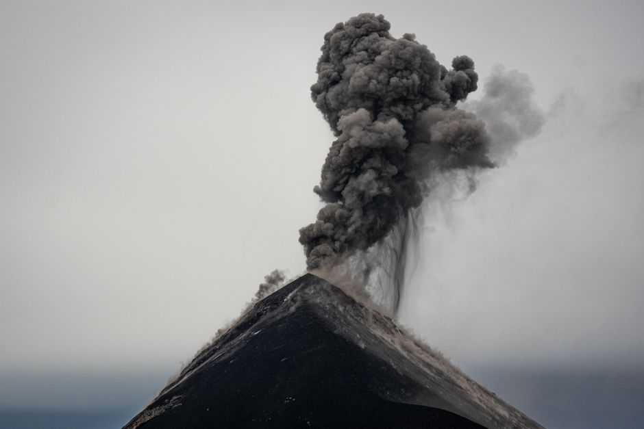
Photo by Diego Girón on Pexels
There are three main types of plate boundaries, and each one creates different geological features and hazards:
Divergent Plate Boundaries
Here, plates are pulling apart from each other.
* Movement: Plates move away.
* Geological Features: Mid-ocean ridges (like the Mid-Atlantic Ridge), rift valleys (like the East African Rift Valley), volcanoes.
* Hazards: Shallow earthquakes, volcanic eruptions (usually less explosive).
* Example: As the North American plate and Eurasian plate pull apart, new crust is formed, creating the Mid-Atlantic Ridge and volcanoes in Iceland.
Convergent Plate Boundaries
Here, plates are pushing together. There are three sub-types:
1. Oceanic-Continental: An oceanic plate (denser) collides with a continental plate (less dense). The oceanic plate is forced under the continental plate in a process called subduction.
* Geological Features: Ocean trenches, fold mountains, chains of explosive volcanoes (like the Andes Mountains).
* Hazards: Powerful, deep earthquakes; explosive volcanic eruptions; tsunamis.
* Example: The Nazca plate subducting under the South American plate creates the Andes and their volcanoes.
2. Oceanic-Oceanic: Two oceanic plates collide. One subducts under the other.
* Geological Features: Ocean trenches, volcanic island arcs (chains of islands formed by volcanoes).
* Hazards: Strong earthquakes, explosive volcanic eruptions, tsunamis.
* Example: The Pacific plate subducting under the Mariana plate forms the Mariana Trench and Mariana Islands.
3. Continental-Continental: Two continental plates collide. Neither can subduct easily because they're both relatively light. Instead, the crust crumples and folds upwards.
* Geological Features: Very high fold mountains (like the Himalayas).
* Hazards: Strong, shallow earthquakes; very little volcanic activity.
* Example: The Indian plate colliding with the Eurasian plate formed the Himalayas.
Conservative (or Transform) Plate Boundaries
Here, plates are sliding past each other horizontally.
* Movement: Plates slide sideways.
* Geological Features: Fault lines (cracks in the Earth's crust).
* Hazards: Frequent and powerful earthquakes, but generally no volcanoes.
* Example: The Pacific plate and North American plate slide past each other along the San Andreas Fault in California, causing many earthquakes.
Here’s a summary diagram of how these processes link:
graph TD
    A["Mantle Convection Currents"] --> B["Movement of Tectonic Plates"]
    B --> C["Plate Boundaries"]
    C --> D1("Divergent Boundary (Pulling apart)")
    C --> D2("Convergent Boundary (Pushing together)")
    C --> D3("Conservative Boundary (Sliding past)")

    D1 --> E1("New crust formed")
    D1 --> F1("Mid-ocean ridges, rift valleys")
    D1 --> G1("Volcanoes, shallow earthquakes")

    D2 --> E2("Crust destroyed (subduction) or uplifted (collision)")
    D2 --> F2("Ocean trenches, fold mountains, island arcs")
    D2 --> G2("Strong earthquakes, explosive volcanoes, tsunamis")

    D3 --> E3("Crust neither formed nor destroyed")
    D3 --> F3("Fault lines")
    D3 --> G3("Strong, frequent earthquakes")
Associated Hazards

Photo by Chris Brown on Pexels
The movement at plate boundaries causes earthquakes (sudden shaking of the ground) and volcanic eruptions (molten rock, ash, and gases escaping to the surface).
* Earthquakes: Caused by the sudden release of built-up stress as plates move. The point where the earthquake originates underground is the focus, and the point directly above it on the surface is the epicentre.
* Volcanoes: Formed where magma (molten rock) rises to the surface. Most occur at divergent boundaries (creating new crust) or convergent boundaries (through subduction).
* Tsunamis: Giant ocean waves caused by large-scale displacement of water, often triggered by underwater earthquakes (especially at subduction zones), volcanic eruptions, or landslides.
3. Worked Example
Let's consider the 'Ring of Fire' around the Pacific Ocean. This isn't one type of boundary, but a string of interconnected convergent plate boundaries (mostly oceanic-continental and oceanic-oceanic).
Imagine the Pacific Plate, which is a massive oceanic plate. It's largely surrounded by other plates (like the North American, Eurasian, Indo-Australian, and Nazca plates). At many of these interfaces, the Pacific Plate is subducting under the less dense plates surrounding it.
For example, along the western edge, the Pacific Plate subducts under the Philippine Sea Plate and Eurasian Plate. This subduction creates deep ocean trenches (like the Mariana Trench) and causes magma to rise, forming volcanic island arcs (like Japan and the Philippines). The friction and stress as these plates grind past each other also lead to very frequent and powerful earthquakes. If a large underwater earthquake occurs, it can displace huge volumes of water, generating devastating tsunamis.
This continuous subduction and collision explains why the Ring of Fire accounts for about 90% of the world's earthquakes and 75% of its active volcanoes.
4. Key Takeaways
- The Earth's lithosphere is divided into tectonic plates that are always moving.
- Convection currents in the mantle drive the movement of these plates.
- Divergent boundaries see plates pulling apart, creating new crust and volcanoes.
- Convergent boundaries involve plates colliding, leading to subduction, mountain building, and explosive volcanoes.
- Conservative boundaries have plates sliding past each other, causing frequent strong earthquakes but no volcanoes.
- Most earthquakes and volcanoes are concentrated along plate boundaries.
- Tsunamis are often triggered by large underwater earthquakes at subduction zones.
- Understanding plate tectonics helps us predict and prepare for geological hazards.
Common Mistakes to Avoid:
- Don't confuse the lithosphere (crust + upper mantle) with just the crust.
- Don't think all volcanoes are the same; divergent boundary volcanoes are usually less explosive than subduction zone volcanoes.
- Remember that conservative boundaries produce earthquakes but generally no volcanoes.
- Don't forget that continental-continental collisions create mountains but very few volcanoes, unlike other convergent boundaries.
5. Now Try It
Choose one major earthquake or volcanic eruption that has occurred in the last 20 years. Research which tectonic plates were involved and identify the type of plate boundary where the event happened. Then, explain why that specific type of boundary led to that particular hazard. For example, if it was an earthquake at a convergent boundary, explain the subduction process and how it causes seismic activity. Your answer should be around 100-150 words.
Frequently asked about Plate Tectonics and Associated Hazards
More from geography for y9 students at chms exam
Get the full geography for y9 students at chms exam curriculum
Clone the complete plan to your dashboard for unlimited AI-generated notes, practice quizzes, and a personalised revision schedule.
Save this course free