Introduction to Geography and Mapping
From the Geography curriculum
Introduction to Geography and Mapping
TL;DR
Geography is the study of Earth's features and phenomena, focusing on "where" things are and "why" they're there. Mapping is how we represent these features visually, using tools like coordinates, scale, and projections. Understanding these basics helps you interpret and create maps to better understand the world around you.
1. The Mental Model
Think of geography as asking "where is it?" and "why is it there?" for everything on Earth, from mountains to cities to weather patterns. Mapping is simply the universal language we use to draw these answers, making sense of vast, complex spaces on a manageable surface.
2. The Core Material
Geography isn't just memorizing capitals; it's a science of spatial relationships. You'll explore how physical features (like climate and landforms) interact with human activities (like population and culture).
Branches of Geography
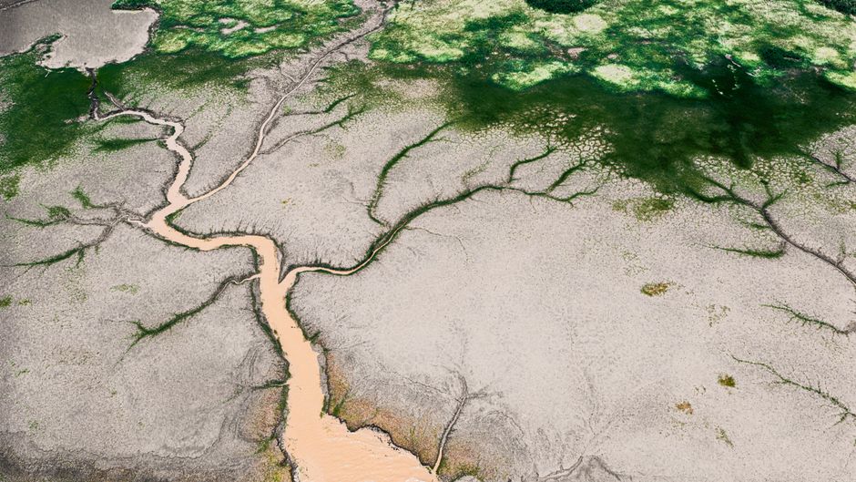
Photo by Fu Shan Un on Pexels
Geography generally splits into two main areas:
* Physical Geography: Studies natural features like landforms, climate, water, and ecosystems. Think mountains, rivers, weather.
* Human Geography: Studies how human activity affects and is affected by the Earth's surface. Think cities, populations, cultures, economies.
What is a Map?

Photo by Tima Miroshnichenko on Pexels
A map is a symbolic representation of selected characteristics of a place, usually drawn on a flat surface. It simplifies reality to help us understand it.
Key Map Elements

Photo by Bakr Magrabi on Pexels
Every good map shares some fundamental characteristics:
- Scale: This tells you the relationship between a distance on the map and the actual distance on the ground. For example, 1:100,000 means 1 unit on the map equals 100,000 units in reality.
- Orientation/Direction: A compass rose or North arrow shows which way is North.
- Legend/Key: Explains the symbols, colors, and patterns used on the map.
- Grid/Coordinates: A system (like latitude and longitude) for pinpointing exact locations.
- Title: What the map is about.
Coordinates: Latitude and Longitude

Photo by Lara Jameson on Pexels
These are the most common ways to locate a point on Earth.
- Latitude: Lines running east-west, parallel to the Equator. They measure distance north or south of the Equator (0 degrees latitude). The North Pole is 90°N, the South Pole is 90°S.
- Longitude: Lines running north-south, from pole to pole. They measure distance east or west of the Prime Meridian (0 degrees longitude), which passes through Greenwich, London.
graph TD
    A["What is Geography?"] --> B["Study of Earth's Features and Phenomena"]
    B --> C["Why is it there?"]
    B --> D["Where is it?"]

    C --> E["Physical Geography"]
    C --> F["Human Geography"]

    D --> G["Mapping"]
    G --> H["Scale"]
    G --> I["Orientation"]
    G --> J["Legend"]
    G --> K["Coordinates"]

    K --> L["Latitude (North/South of Equator)"]
    K --> M["Longitude (East/West of Prime Meridian)"]

    H --> N["Map Distance : Real World Distance"]
3. Worked Example
Imagine you're planning a trip. You find a map of your destination with a scale of 1:50,000. You measure the distance between your hotel and a museum on the map with a ruler, and it's 3 cm.
To find the real-world distance:
- Understand the scale: 1 unit on the map = 50,000 units in reality.
- Apply to your measurement: 3 cm on the map.
- Calculate real distance: 3 cm * 50,000 = 150,000 cm.
- Convert to more practical units:
- 150,000 cm / 100 cm/m = 1,500 meters
- 1,500 meters / 1,000 m/km = 1.5 kilometers
So, the museum is 1.5 kilometers from your hotel.
4. Key Takeaways
- Geography helps you understand the spatial organization of the world and its phenomena.
- Physical geography focuses on natural Earth systems, while human geography focuses on human interactions with the Earth.
- Maps are simplified representations of reality, essential for navigation and analysis.
- Map scale is crucial for converting map distances to real-world distances.
- Latitude and longitude provide a universal grid system for precise location.
- Every good map includes a title, legend, scale, and indication of direction.
Common Mistakes to Avoid:
* Forgetting to check the map's scale when estimating distances.
* Ignoring the legend and misinterpreting symbols.
* Confusing latitude and longitude or mixing up North/South with East/West.
* Assuming a map is perfectly accurate; all maps have some distortion.
5. Now Try It
Grab a physical map (e.g., a local tourist map, a road atlas, or even a printed Google Maps view). For about 15 minutes, identify and label all the key map elements we discussed: title, legend, scale, North arrow, and find the coordinates (if provided). Pick two points on the map and, using the scale, calculate the approximate real-world distance between them. Write down your findings and calculations. What does the map's legend tell you about the area?
Frequently asked about Introduction to Geography and Mapping
Get the full Geography curriculum
Clone the complete plan to your dashboard for unlimited AI-generated notes, practice quizzes, and a personalised revision schedule.
Create Free Account